When it comes to navigating the vast and unpredictable waters, having the right tools is essential for safety and precision. Marine maps are indispensable for anyone venturing out to sea, whether for leisure or professional purposes. These specialised maps provide detailed information on coastlines, water depths, currents, and more.
In this guide, we’ll take you through the key steps in using marine maps effectively, ensuring you’re well-equipped for your maritime journey.
Understanding the Basics of Marine Maps
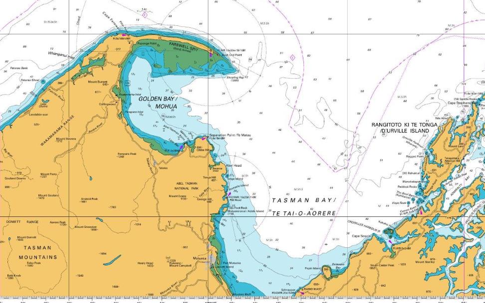
Before setting out, it’s important to familiarise yourself with the components of a marine map. These maps typically feature key elements like depth contours, navigational hazards, and coastline features. The scale of the map is crucial as it determines the level of detail provided, and many maps are designed to cover both large and small areas.
Identifying Key Features on the Map
One of the first things to look for on a marine map is the water depth, which is often depicted with contour lines. These lines indicate areas of shallow or deep water, helping you navigate around submerged rocks or reefs. In addition, buoys and other navigational markers are often displayed, showing safe entry points or the boundaries of channels. Nautical maps often provide further information, such as the location of ports and lighthouses, which can be invaluable for longer journeys.
Reading the Compass Rose and Scale
To ensure proper orientation, marine maps feature a compass rose that helps you align your route with the cardinal directions: North, South, East, and West. The scale of the map is equally important—it tells you the actual distance between points. By using this scale, you can calculate travel times and plan your course accurately.
Plotting Your Course
Once you understand how to read the symbols, scale, and depth contours, you can begin plotting your course. Start by identifying your current location on the map, then trace a safe route to your destination. Pay attention to any hazards or obstacles along the way, such as submerged rocks, shoals, or currents.
Double-Check for Accuracy
Before heading out, always double-check your plotted course and ensure the map is up-to-date. Changes in the coastline or underwater features can alter your route, so it’s crucial to have the latest information available.
By mastering the use of marine maps, you’ll gain the confidence needed to navigate the seas with ease. With accurate plotting, proper understanding of symbols, and attention to detail, you’ll ensure a safer and more enjoyable maritime experience.

 Home
Home


